Trees Near Me
Mapping the trees of New South Wales
Overview.
Developed in close collaboration with environmental scientists in the NSW government, the Trees Near Me app brings
a detailed vegetation map of the entire state into the hands of citizens.
UX and UI
Mobile Apps
Website
Complex Maps
The Brief.
The NSW Department of Climate Change, Energy, the Environment and Water (DCCEEW) has led the way in its adoption
of the 'open data' philosophy, with the publication of a large suite of environmental data through the NSW
Government's existing SEED portal (The Central Resource for Sharing and Enabling Environmental Data in NSW).
While the depth of this data is very impressive, accessing and understanding the data is generally beyond the
reach of lay users.
The brief for the Trees Near Me NSW app was to develop a software solution that integrated with the technical
resources available through the SEED portal and presented that data in an easily accessible and understood mobile
app. The app would be freely available to the public and needed to support iOS and Android phones, as well as
providing a web-based version for desktop access.
Design Challenge.
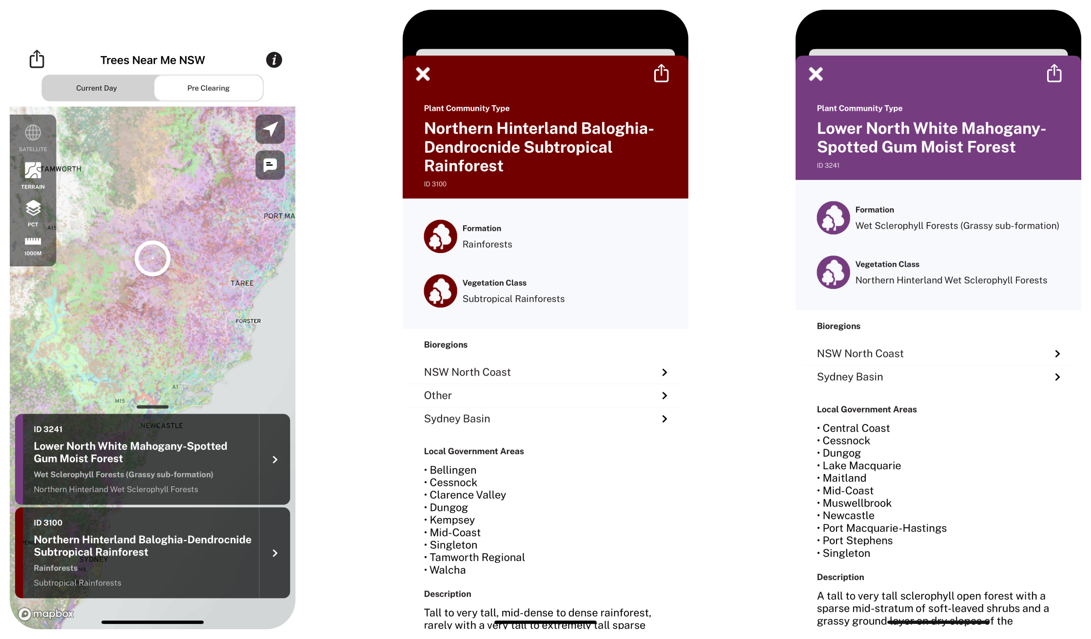
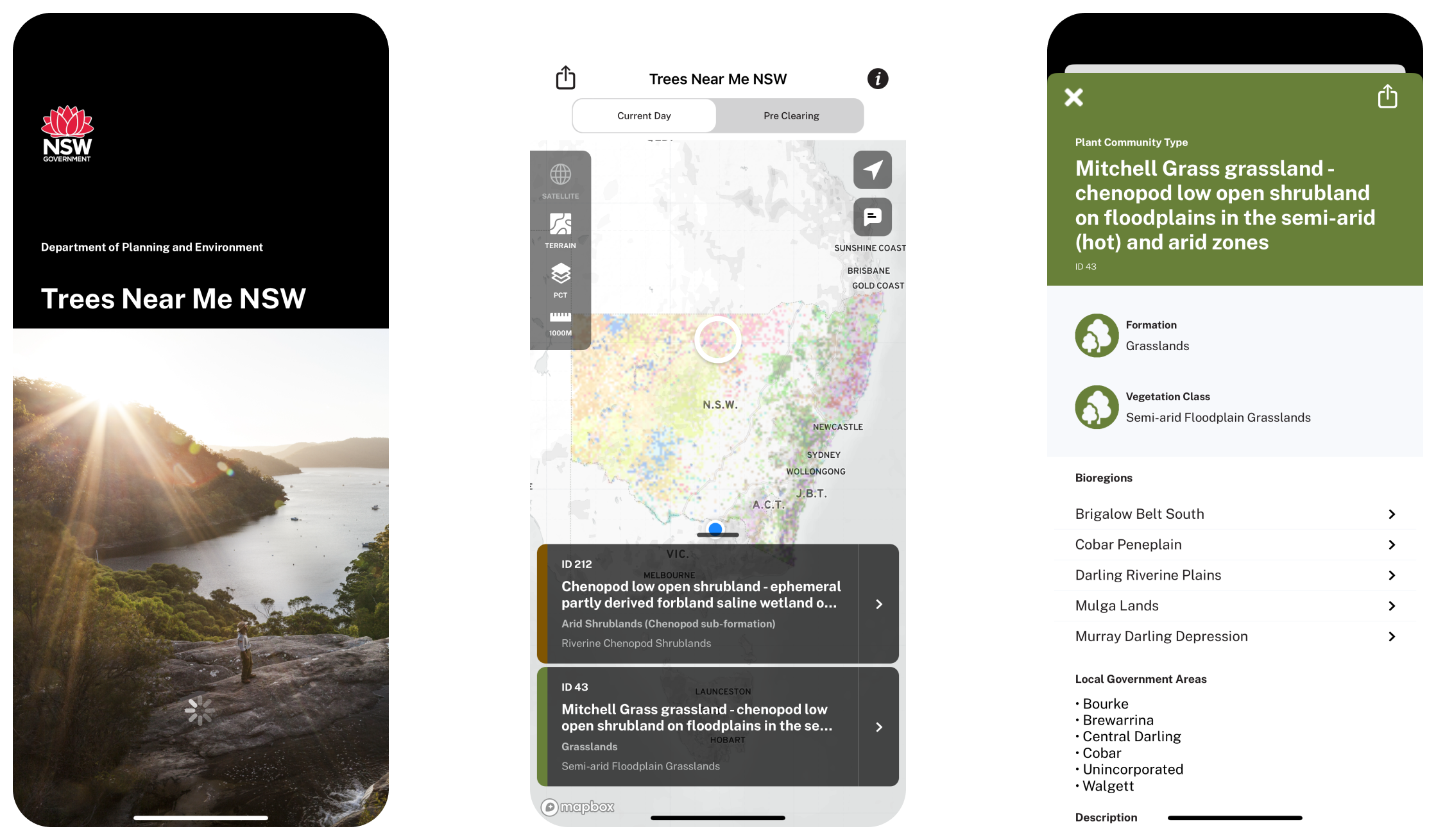
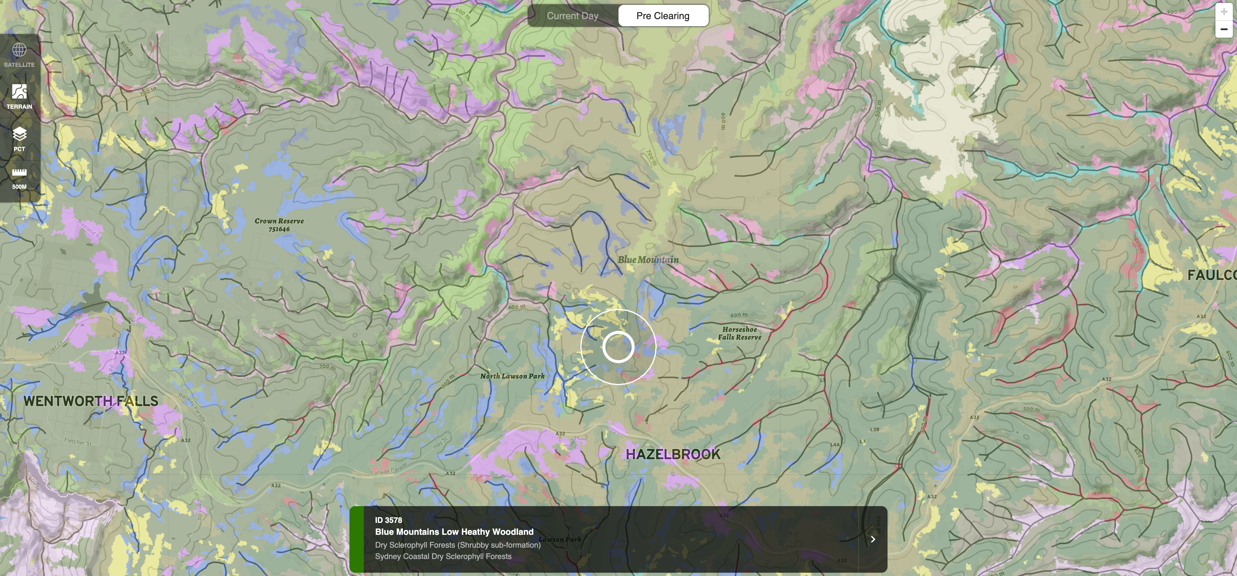
The greatest challenge in designing the Trees Near Me NSW mobile app was the translation of a complex,
geospatial dataset into an intuitive interface that immediately demonstrated its value to end users.
Our approach typifies the keep-it-simple approach to design. Upon launch (following some brief onboarding for
brand new users), the user is immediately presented with a map, centered on their current location. Without any
interactions, the app then presents the user with a summary of the types of vegetation at that location. Searching
other locations requires no filling out forms, no registration, nor knowledge of the domain - rather the user is
empowered to simply discover the vegetation growing throughout the state by panning and zooming around the map.
While the presentation of the app appears incredibly simple, it belies the complexity of the data and software
architecture powering the app. Rastered map tiles are served directly from NSW Government servers, while
asynchronous queries to determine the location around target areas is performed via an optimised, bespoke API.
Augmenting this information is data imported from a third source, the NSW Government's BioNet portal.